
Building surveys
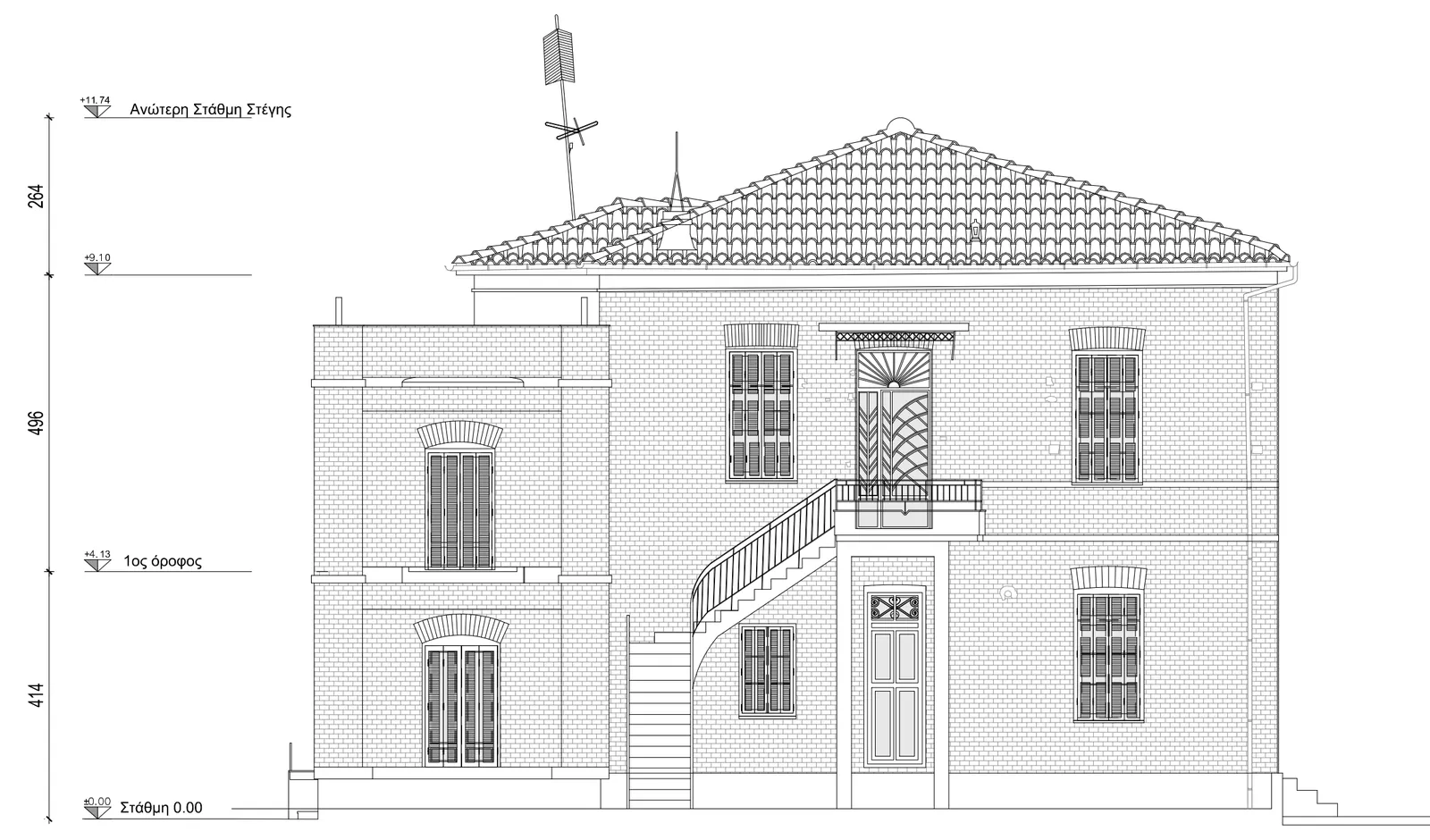
Floor plans, elevations and sections of the existing building, drawn from the point cloud.
DWG · PDF · 1:50 / 1:100
We survey the existing building. You design what comes next.
Point clouds, DWG drawings, orthophotos and Revit or ArchiCAD models.
3D scanner: Leica RTC360, one of the most accurate devices on the market.
Both the survey and the processing are carried out by engineers with technical insight and know-how, not by mere operators.
Leica RTC360
2,000,000 points / sec
24 hours
to receive a quote
Survey – delivery
from a few hours to 1–2 weeks
LOD up to 500
drawings and BIM models, LOD 200 to 500
Surveys throughout Greece
Services
The scanner measures everything that is visible. You choose what is produced from the point cloud: 2D drawings, 3D models, MEP installations, orthophotos, topographic plans, quantity and volume take-offs.
Level of Detail (LOD) up to 500.
Floor plans, elevations and sections of the existing building, drawn from the point cloud.
DWG · PDF · 1:50 / 1:100
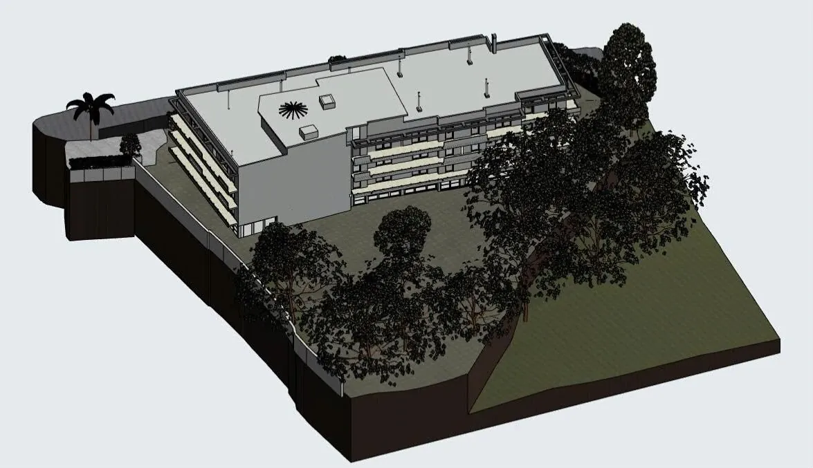
Revit or ArchiCAD model of the existing building, up to LOD 500.
Revit · ArchiCAD · IFC
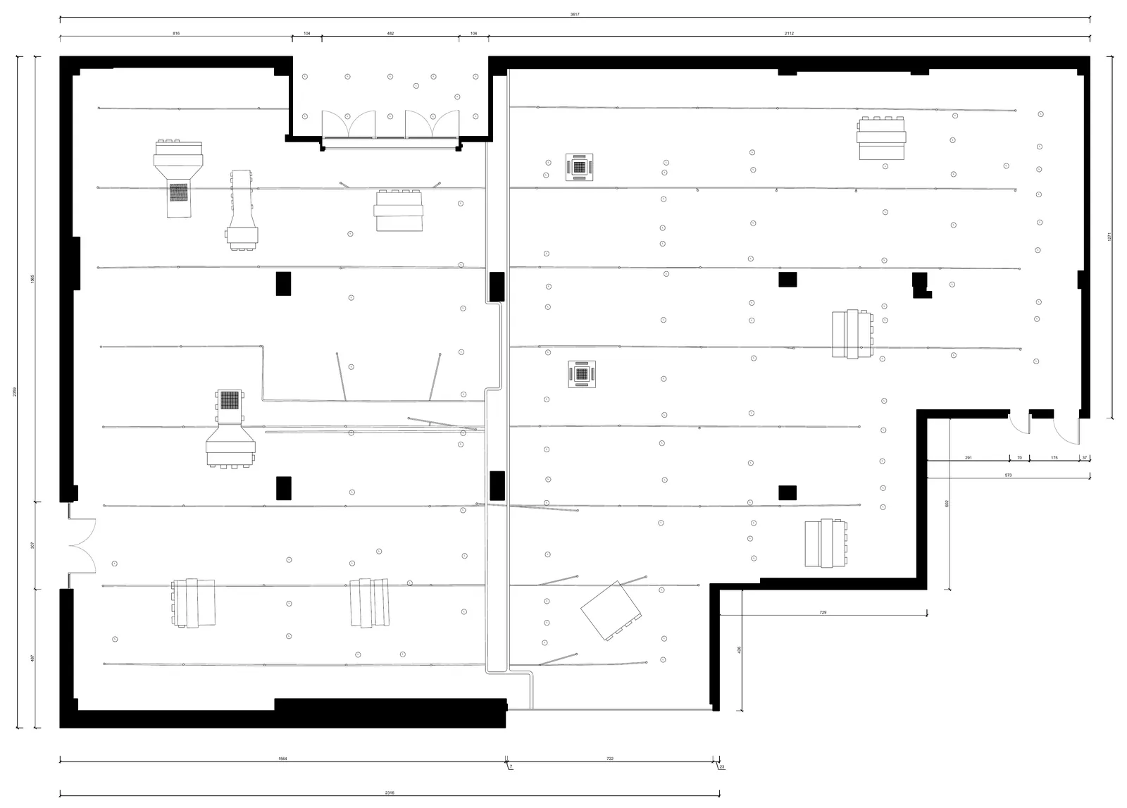
Ducts, pipes, cable trays, plant, light fittings and sprinklers, as 2D drawings or a 3D model.
DWG · Revit · PLN · IFC
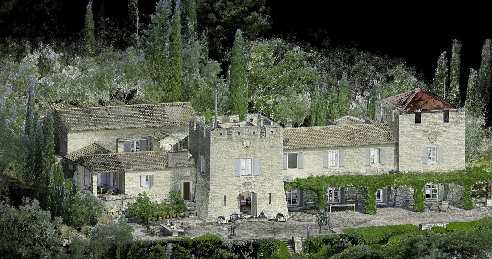
A measurable 3D copy of the site, in colour, with 360° photos and scaled orthophotos.
E57 · RCP · LGSX · TIF · web
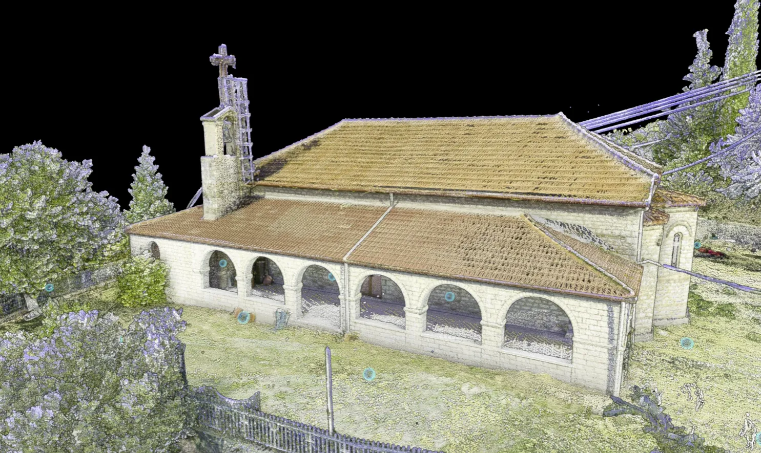
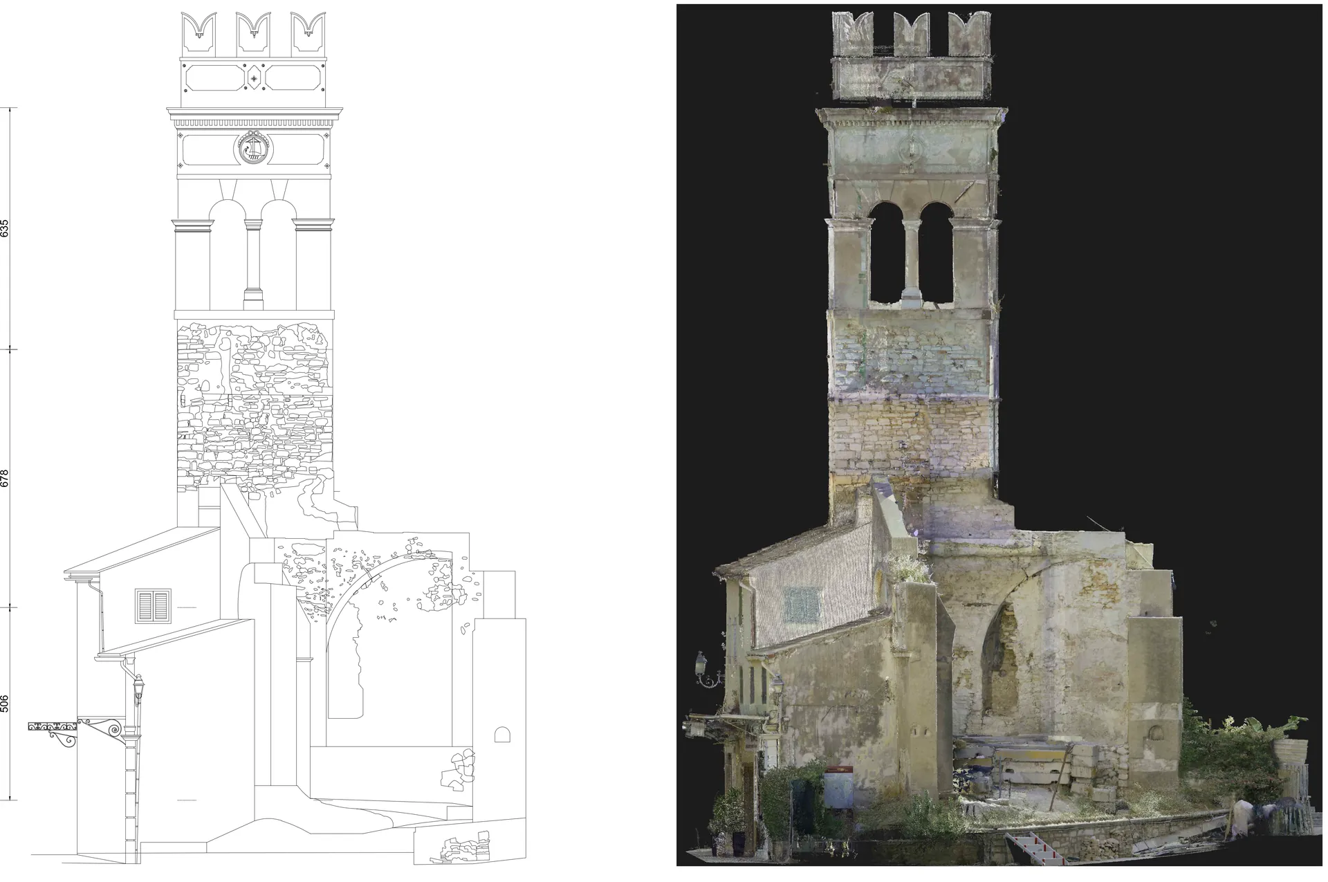
Churches, bell towers, mansions and neoclassical buildings: elevations, sections and orthophotos, without scaffolding.
DWG · orthophotos · point cloud
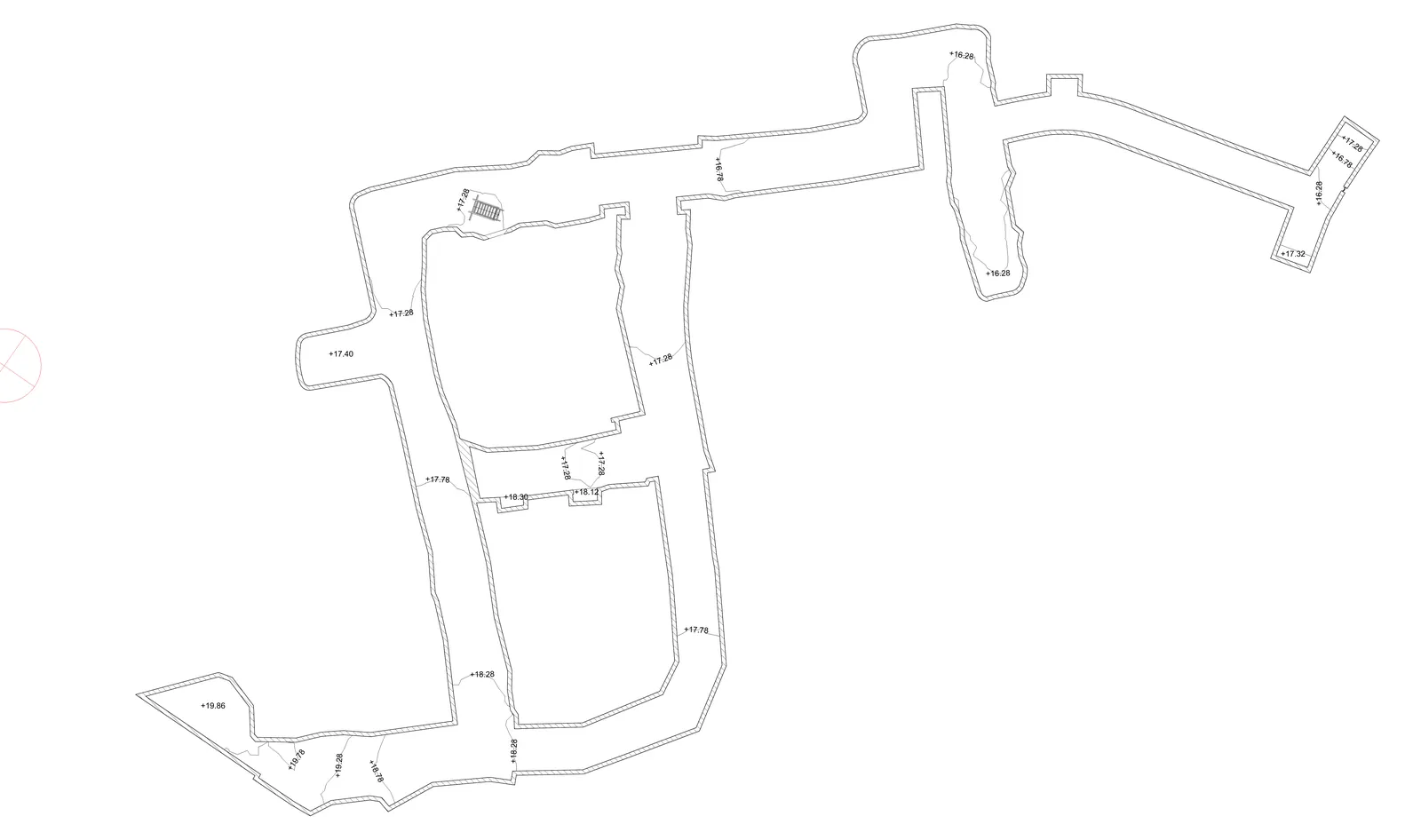
Orthophotos, cross-sections, volume calculations and site monitoring for roads and infrastructure.
DWG · orthophotos · quantities
For owners and architects abroad
Old drawings are often incomplete or do not match what was actually built. Before you sign or start designing, we measure the building as it stands today and deliver as-built plans that you and your architect can rely on.
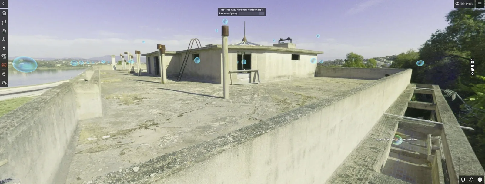
Web access
We send you a link. You open the point cloud and the 360° photos in any browser, without downloading heavy files or installing software.
Projects
Project pages are in Greek.
Attica
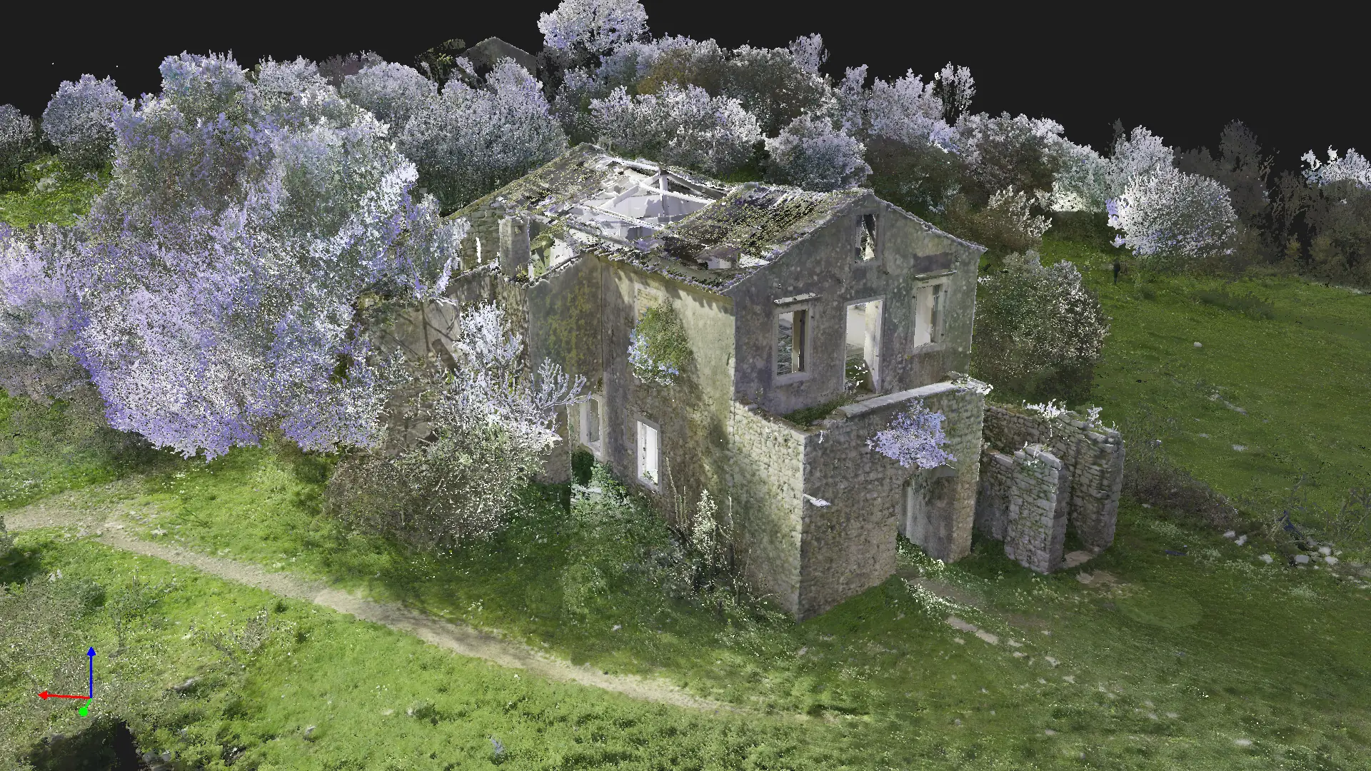
Point cloud · elevations with stonework
Preveza · 2026
Point cloud · elevations · plans · sections
Karditsa
DWG elevations · orthophotos
Scan to BIM
320 scan stations · 4.2 billion points in 3 days
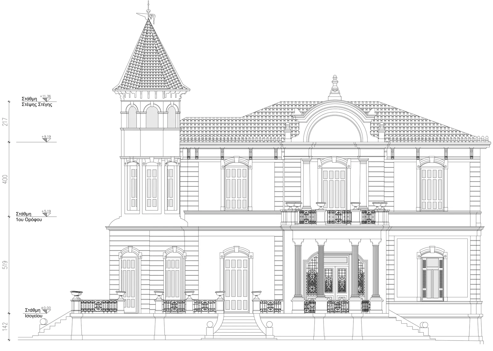
Kifisia · 2025
8 elevations · site plan · orthophotos
Piraeus · 2026
≈100 m of tunnels · plan at 1:50
Method
Send us the address, the approximate floor area, photos or old drawings, and the deliverables you need.
With the Leica RTC360, at successive stations inside and around the building, with a panoramic photo at each station.
The stations are joined, the point cloud is cleaned, and a registration report with the errors is produced.
Drawings, models up to LOD 500 and point cloud in your formats, with web access. From survey to delivery: from a few hours to 1–2 weeks, depending on the project, with the same engineer from start to finish.
About
Theodore Asonitis, civil engineer (National Technical University of Athens, NTUA) with an MSc and an MBA from EPFL, founded AB 3D Scanning. He follows every project from quote to delivery and knows what a drawing needs in order to stand up in a design study, on site or before the authorities.
We work in Greek, English, French, German and Italian. The same team also works in Switzerland: ab-3dscanning.ch.
FAQ
It depends on the size and complexity of the building, the number of scan stations, the deliverables and the scale. We do not publish a price list, because two buildings of the same floor area can require very different work. Send us the location, floor area and deliverables, and you will receive a quote within 24 hours.
It depends on the type, size and complexity of the project. From survey to delivery, it takes from a few hours to 1–2 weeks. For urgent projects we deliver in stages.
Throughout Greece, on the mainland and on the islands. Recent projects include Athens, Kifisia, Piraeus, Preveza, Karditsa and Farsala.
Yes. We send you a link and you open the point cloud and the 360° photos in any web browser, without downloading heavy files or installing software. You can move from station to station and measure distances. For offline viewing we also deliver Leica TruView.
Yes. Title blocks, labels and notes can be prepared in English or French on request, and we communicate in Greek, English, French, German and Italian.
Contact
Address, approximate floor area and deliverables: you will receive a quote within 24 hours.